Stop 5 of 12
Acoustic ecology and weed control
Acoustic sensor
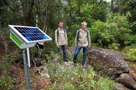
Solar-powered acoustic recorders that listen to SERF's ecosystems as part of the Australian Acoustic Observatory.
Look forLook for a solar-powered acoustic recorder on a tree or steel post, and the contrast between treated and untreated lantana patches.
Watch field note
A short video connected to this stop.
Captions, transcript and media credit pending confirmation.
What this is
- Ecologists use sound recordings to identify and monitor animals and ecosystems.
- Acoustic recorders are solar powered and mounted on trees or steel posts. Each stores data on high-capacity SD cards, collected and replaced at least once a year.
- Four acoustic sensors are deployed at SERF, part of the Australian Acoustic Observatory.
Why it matters
- Listening over time lets researchers judge ecosystem health and gather data from remote locations without constant physical visits.
- SERF hosts many audible species, including Australia's largest nocturnal bird, the Powerful Owl (Ninox strenua).
What to notice
- Areas with active lantana (Lantana camara) control alongside untreated patches. Uncontrolled lantana forms dense thickets that smother native vegetation.
- Lantana can look different from place to place because it modifies its growth to adapt to new environments, and releases allelochemicals that inhibit other plants.
Research connection
Acoustic data feeds the Australian Acoustic Observatory, while manual removal, herbicide and biological control are being trialled to restore native vegetation at SERF.
Source: QUT Engaging Science Trail, Stop 5
Open in maps
If your preview blocks the map page, copy the link and open it in a new tab.
External maps open the stop location only. Use the in-app trail overview for moving between stops.
Next on the trail
Stop 6: Opening to cleared pasture
Follow the loop toward the opening to cleared pasture.
Orientation assist
The next stop is roughly west from here. Use the trail map and site signs or markers where available to stay oriented.
When you arrive, look forLook for the opening to cleared pasture, the regenerating forest bank and the grassy wetland gully.
Follow the numbered trail overview and site signs or markers where available.
Can't find the next stop?
Return to the trail map and check the nearest on-site marker or sign. Stay on marked public paths and do not rely on this prototype for turn-by-turn navigation.
Back to trail mapWas this useful on the ground?
Local prototype feedback. Stored on this device only.